Places – Sandycove
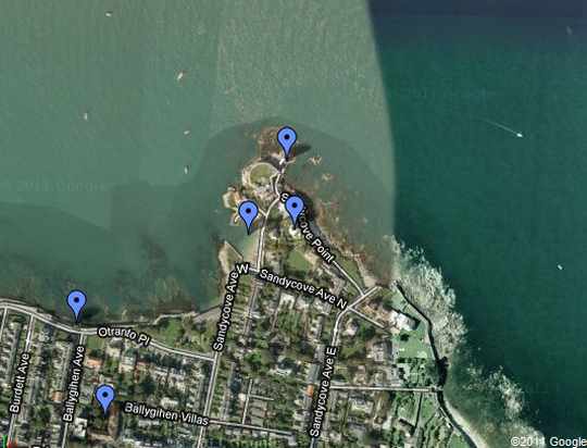
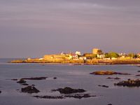 Sandycove — a quiet residential neighbourhood, bordering Glasthule. Sandycove Point marks the southern tip of Dublin Bay. It features a harbour (now popular as a family beach), an old artillery battery (which conceals the Forty Foot), and the famed Martello tower (now the James Joyce Museum).
Sandycove then, as now, was a haven of terraced villas and detached lodges, the preferred residence of the genteel and the retired – and of Synge, Yeats, Heaney ...
Wikipedia: Sandycove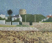
Martello towers — small defensive towers erected along the Irish coast during the Napoleonic invasion scares of the early 19th century. They were stone-built, 40 feet high, with eight foot thick walls, and the entrance door was usually ten or fifteen feet above the ground.
The Martello at Sandycove now houses the James Joyce Museum. Joyce spent six nights here in 1904. The opening scene of Ulysses – when "Stately, plump Buck Mulligan" appears in his yellow dressing gown "ungirdled" – is set upon the gun platform on its roof.
Wikipedia: Martello tower
Wikipedia: James Joyce Museum

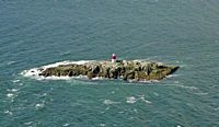
the Muglins — an islet in Dublin Bay, about a third of a mile off Dalkey Island and about two miles offshore from the Forty Foot. The rock was a danger to shipping – there were thirteen wrecks in the area in the 1870s. A stone beacon was erected in 1880; an oil-gas light added in 1906. In 1914 the light's character was changed from "occulting" to "flashing" red every five seconds. It now flashes white with a range of 11 nautical miles.
"Little more than a rock to hold the light that told the rock's existence."
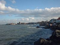
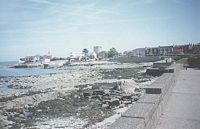
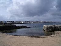
the sea-wall — a masonry embankment and pathway along the shore from Kingstown (now Dún Laoghaire) to Sandycove. In 1922 much of it was replaced by "Marine Parade" and the new shore road.
The wall features prominently in L.A.G Strong's novel, The Sea Wall: